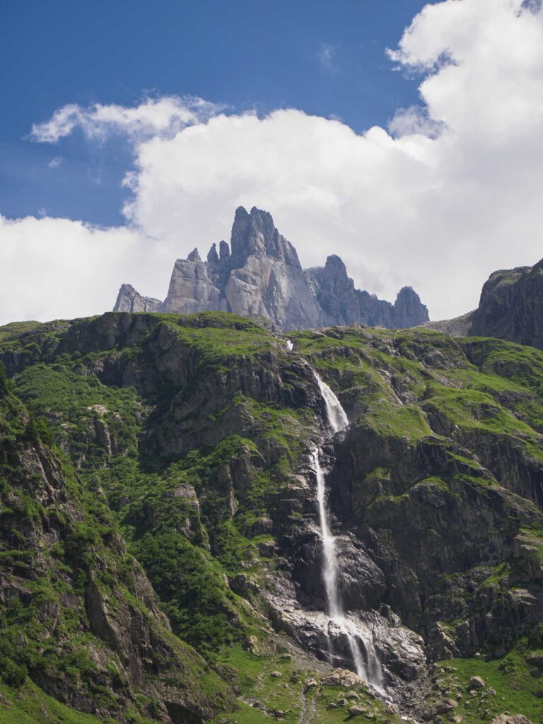
Glaciers underfoot, rock in your hands: the Rotstöckli combines both – at 2,901 metres, right next to the Titlis.
Nidwalden's highest peak is an independent, rocky mountain. A varied high-alpine tour for anyone looking for alpine terrain above Engelberg.
Summit
2,901 m
Difficulty
ZS / K3*
Time required
approx. 5 hours
Season
June – November
Ascent
approx. 700 vertical metres
Descent
approx. 700 vertical metres
Entrance
2,428 m
Area
Titlismassiv
Details depend on route and conditions.
*Not an official via ferrata – see notes below.
Over ice and rock
Route description
01
Over the Titlis glacier
The ascent is usually made from the Stand station. From there, the route leads via the Titlis glacier towards Rotstöckli. Crevasse fields, bare ice and snow bridges can significantly change the character of the tour.
02
Through the rock to the summit
The final ascent crosses partially loose rock. Careful climbing and consideration for following rope teams are particularly important here.
03
Back or onwards to Titlis
The descent is via the same route to Stand or via the Titlis massif with Rotegg or Titlis Rotair – depending on conditions and the chosen option.
Route overview Rotstöckli. Click on the map to enlarge.
The route in detail
Topo Rotstöckli
Click on the topo to enlarge.
This is what you bring to the table
Requirements
The Rotstöckli is a high-altitude tour for mountaineers with experience in alpine terrain.
Safe walking with crampons
Experience on glaciers
Surefootedness in friable rock
Safe rope handling
Some climbing experience
Insight into the tour
Rotstöckli Gallery
Rock beneath the hands, glacier ice at the back: On the ascent on the back of the Rotstöckli above Engelberg. Photograph taken on 1 September 2026.
Ascent to the Rotstöckli in the Titlis area near Engelberg on 1 September 2026. The image shows a mountaineer with a helmet and rucksack on a wire-rope-secured rock passage on the rear side of the summit. Behind, the Steinberggletscher extends with exposed ice surfaces and numerous crevasses. Wisps of mist drift across the ice, underlining the high-alpine character of the scenery.
Via the glacier track towards Rotstöckli. As soon as the protective fleece is removed, the ascent is best made with crampons. Photograph from 1 September 2026.
Ascent to the Rotstöckli via the glacier piste on the Titlis above Engelberg. A mountaineer is climbing up the irregular ice surface using crampons and poles. In the background, the glacier ski lift installation stands under a cloudless sky. After the protective fleece has been removed, the ice is exposed – mountain guide Dani Perret recommends crampons for this section. The photograph documents the conditions on 1st September 2026.
From the summer path down to the glacier: A steep metal ladder bridges the rock step on the approach to the Rotstöckli. Taken on 1st September 2026.
The ladder section connects the summer route with the glacier on the approach to the Rotstöckli in the Titlis area near Engelberg. Viewed from above, the photograph shows two mountaineers on the metal ladder fixed to the rock. Below, the view opens up onto a barren landscape of rock slabs, scree and isolated snowfields. Documented on 1st September 2026.
Late summer on the glacier piste at Titlis: white protective fleeces cover individual areas, alongside which ice and rock lie exposed. Photograph from 1 September 2026.
View of the glacier slope on the Titlis above Engelberg on 1 September 2026. The overview shows the structured ice surface, steep ice edges and the exposed rock in the lower area. White protective fleece covers parts of the slope and extends over a terrain edge in the foreground. Ski lift pylons and technical installations mark the infrastructure amidst the late summer glacier landscape.
The summer path leads upwards over rock steps and scree. Behind lies the Trübsee, framed by alpine pastures and rugged mountain ranges. Photo taken on 1 September 2026.
Ascent via the summer route on the approach to the Rotstöckli in the Titlis area near Engelberg. In the foreground, a female mountaineer is negotiating a rock step with her hands, followed behind by a male mountaineer with poles through the stony terrain. The view back extends over the rocky slopes to the Trübsee and the surrounding alpine pastures. The photograph from 1 September 2026 shows the transition from the green mountain landscape to the barren rocky terrain.
Nidwalden's highest point emerges from the fog: the Rotstöckli with its steep rock faces and the small summit cross. Photograph taken on 1 September 2026.
The Rotstöckli in the Titlis area near Engelberg, the highest point in the Canton of Nidwalden, amidst rolling wisps of mist. Through a break in the fog, the rugged rock towers and steep faces emerge. On the topmost rocky outcrop, the summit cross is silhouetted against the bright sky. The photograph taken on 1 September 2026 shows the striking peak in an interplay of rock, light, and clouds.
Arrived at the top: on the summit of the Rotstöckli, the highest point in Nidwalden. Behind it, the glacier expanses stretch up towards the Titlis. Photograph taken on 1 September 2026.
Two mountaineers on the rocky summit of the Rotstöckli in the Titlis region near Engelberg. Wearing helmets, climbing harnesses and backpacks, they stand beside the summit marker and smile at the camera. In the background, glacier fields crossed by crevasses and the facilities on the Titlis can be seen. Banks of cloud lie over the surrounding valleys, while the summit is in the sunshine. Photograph taken on 1 September 2026.
Rock and ice close together: On the move along the fixed rope of the Rotstöckli with a view of the glacier areas on the Titlis. Taken on 1 September 2026.
A female mountaineer is standing on a narrow ledge on the Rotstöckli, holding onto the wire cable. Her helmet, climbing harness and via ferrata set are clearly visible. Behind her, the glacier surface, characterised by crevasses and melt channels, stretches towards the facilities on the Titlis. The photograph, taken on 1 September 2026, shows the close proximity of rocky summit terrain and glacial ice above Engelberg.
The final metres of the steep ascent: the via ferrata section on the Rotstöckli demands difficulty levels of K3–K4. Beyond it, the view falls directly onto the glacier. Taken on 1 September 2026.
A mountaineer reaches the upper end of the steep, wire-rope-secured ascent on the Rotstöckli in the Titlis region near Engelberg. The passage, graded K3–K4, leads through steep, well-structured rock. The view from above highlights the exposed position above the glacier, whose open crevasses and ice surfaces, partially covered with protective fleece, form the background. Taken on 1 September 2026.
Will this hold as well? A sceptical look at the loose scree on the Rotstöckli – with the glacier ice directly behind. Taken on 1 September 2026.
Close-up of a mountaineer on the rocky ascent to the Rotstöckli near Engelberg. Loose stones and angular rock slabs lie over the next rock ledge. His inspecting gaze is directed at the terrain directly in front of him. A green rope runs through the foreground, while jagged glacier ice is visible in the background. Captured on 1 September 2026.
The first crossing leads right into the steep rock face of the Rotstöckli. Directly beside it, the rugged glacier landscape of the Titlis unfolds. Photograph taken on 1 September 2026.
Two mountaineers on the first traverse into the via ferrata on the Rotstöckli near Engelberg. The passage runs along narrow rock ledges on a steep wall. The wide-angle perspective shows the exposed location and the direct transition between rock and glacier. Open crevasses, grey ice surfaces and white protective fleeces shape the view towards the Titlis. Taken on 1 September 2026.
A summer, a distinct change in elevation: the covered area projects beyond the surrounding, unprotected ice. The person next to it makes the scale visible. Titlis, 1 September 2026.
The photograph shows the striking difference in height between the area of the Titlis glacier piste covered with protective fleece and the adjacent open ice surface after the summer of 2026. The white fleece extends over the steep edge of the preserved snow and ice body. A mountaineer stands directly next to it, providing a sense of scale. The image illustrates the local protective effect of the covering; the exact amount of meltwater saved cannot be determined from this alone. Taken on 1 September 2026 above Engelberg.
A look into the depths and one to the valley: open crevasse on the Titlis with the Trübsee in the background. Taken on 1 September 2026.
A mountaineer wearing a helmet, climbing harness and crampons stands next to an open crevasse on the Titlis Glacier above Engelberg. The dark opening of the crevasse runs through the foreground, revealing steep ice walls. Behind it, the view extends to Trübsee, green alpine pastures and mountain ranges framed by clouds. The photograph, taken on 1 September 2026, documents the exposed ice surface, characterised by meltwater channels, in the late summer.
Via ferrata section at the Rotstöckli
Good to know
Questions about the Rotstöckli
Is the Rotstöckli the highest point of Nidwalden?
Yes. At 2,901 metres, the Rotstöckli is the highest peak in the canton of Nidwalden. Despite its proximity to the Titlis, it is a distinct mountain in its own right.
Can the tour be combined with Titlis?
Yes. Under suitable conditions, the Rotstöckli and the Gross Titlis can be combined into a day tour. This allows you to reach the highest points of Nidwalden and Obwalden. The combination requires a good level of fitness, a sure foot and a head for heights.
Is the Rotstöckli an official via ferrata?
No. The wire rope was originally installed as access for Titlis Bergbahnen employees to the avalanche blasting system. It is used as an ascent and safety aid, but does not meet the standards of an official via ferrata.
Two cantons. One day tour.
Rotstöckli & Titlis with mountain guide
To the Rotstöckli and onwards to the Gross Titlis: Together we are planning an alpine day tour to the highest peaks of Nidwalden and Obwalden – tailored to your ability and the current conditions.
CHF 700.–
per day and mountain guide · excl. lifts and meals