
Paragliding · Dallenwil
Paragliding Wirzweli & Gummen – Launch sites & flight area
There are three different starting points near Dallenwil: at Wirzweli Station, at the Horn, and at Gummen. The guide describes the area for Soaring in the appropriate valley winds and for thermic flights from Gummen.
- Region
- Dallenwil
- Starting places
- 3
- Takeoff altitudes
- 1221–1600 m according to the guide
- Exploration
- Cableway and footpath
- Ground base
- Flight Guide 2023
- Airspace
- Check current conditions before every flight
From the flight guide
The flight area
There are three different starting points near Dallenwil: at Wirzweli Station, at the Horn, and at Gummen. The guide describes the area for Soaring in the appropriate valley winds and for thermic flights from Gummen.
According to the guide, the thermals kick in early during the climb. Later, the north or valley wind can overwhelm the summit. The time mentioned in the book is an experience from 2023 and not a fixed rule for a current flight.
To the starting point
Arrival & Check-in
By the Wirzwelibahn from Dallenwil. From the Dallenwil station check the current connection to the valley station. For Gummen from Wirzweli it takes about 15 minutes to get to the Gummenalpbahn and from there onwards up the mountain.
Space for space
The starting positions
Wirzweli Station
Small takeoff area with a delta ramp. For gliders, the guide describes this area as rather unusual.
- Height
- 1221 m (Guide 2023)
- Orientation
- North
- Coordinates
- 670’711 / 196’307 (LV03, book entry)
- boarding
- at the mountain station
- underground
- Grass
Little space and occasionally high grass.
Horn
Short, steep path to the scenic starting area.
- Height
- 1474 m (Guide 2023)
- Orientation
- North
- Coordinates
- 671’329 / 195’755 (LV03, book entry)
- boarding
- approx. 30 minutes
- underground
- Grass
Check the access and meadow conditions on site.
Gummis
Starting points on the front tire are north and on the southern side.
- Height
- 1600 m (Guide 2023)
- Orientation
- North/Northwest as well as South according to the Guide
- Coordinates
- Contradictory in the PDF; not accepted
- boarding
- about 5 minutes from Gummenalp
- underground
- Grass
Strong valley winds can prevent the return to Hüliboden at Südstart. In case of flooding, changing winds and dust devils are possible.
Orientation
Maps, Topos & Images
All associated graphics from the flight guide are fully reproduced here with their labeled instructions. Maps and topographic maps are displayed in their original aspect ratio. Labels, cable instructions, and markings: as of 2023.

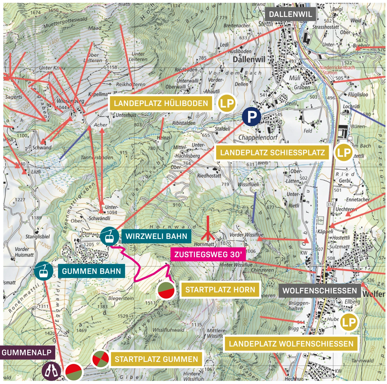

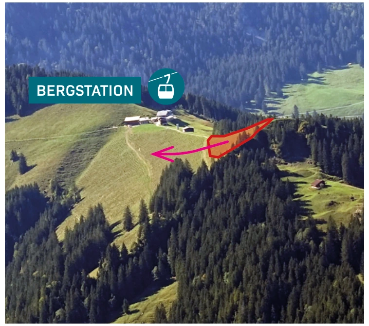
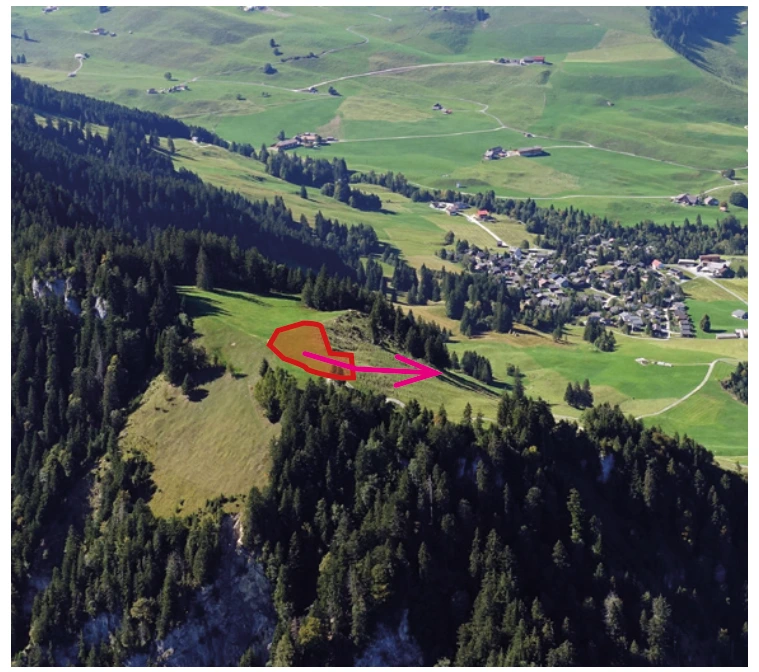
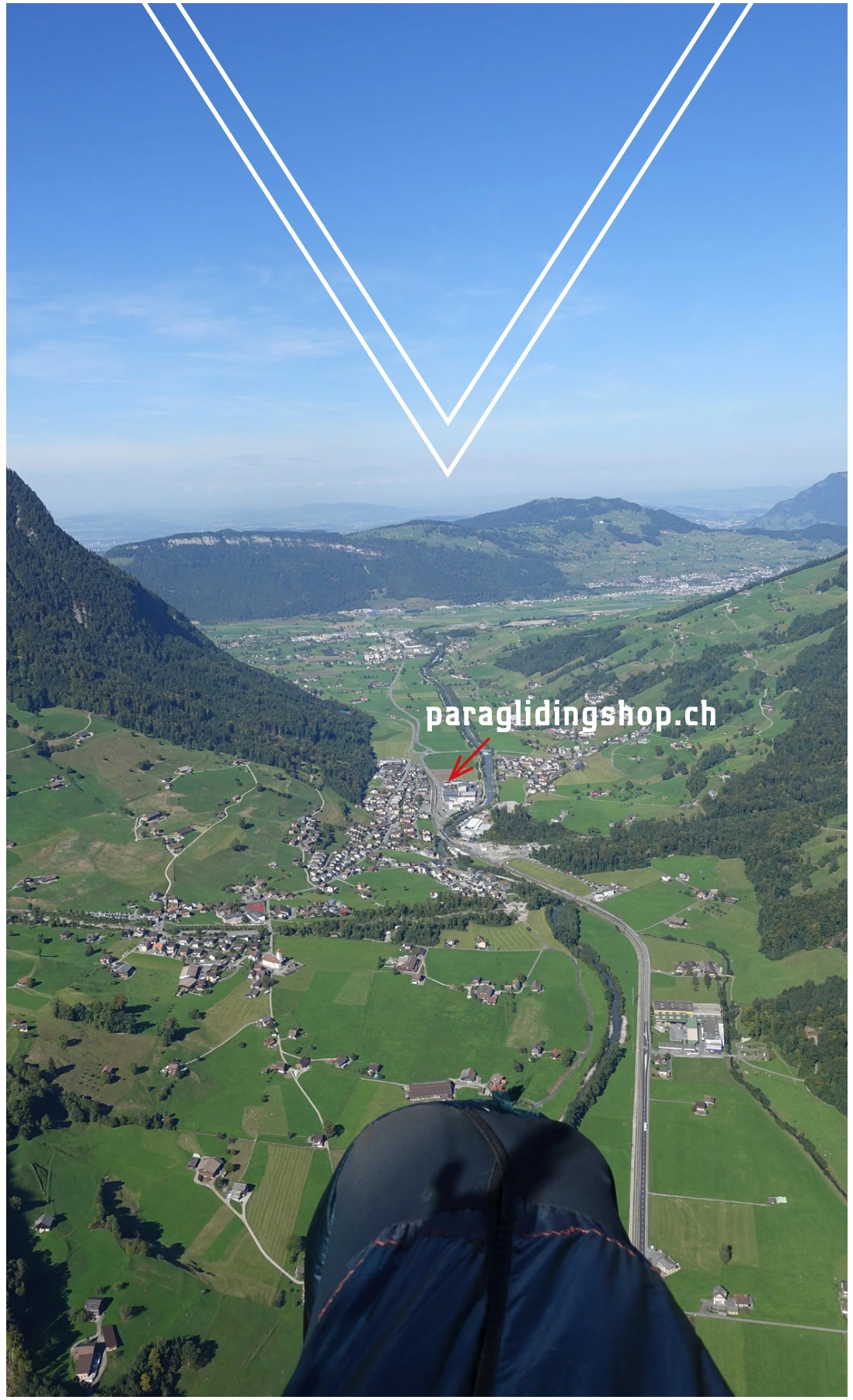
Set goals before starting
Landing places
Choose a suitable and permissible landing before takeoff. The places linked here are area options and do not guarantee the availability of any landing spot.
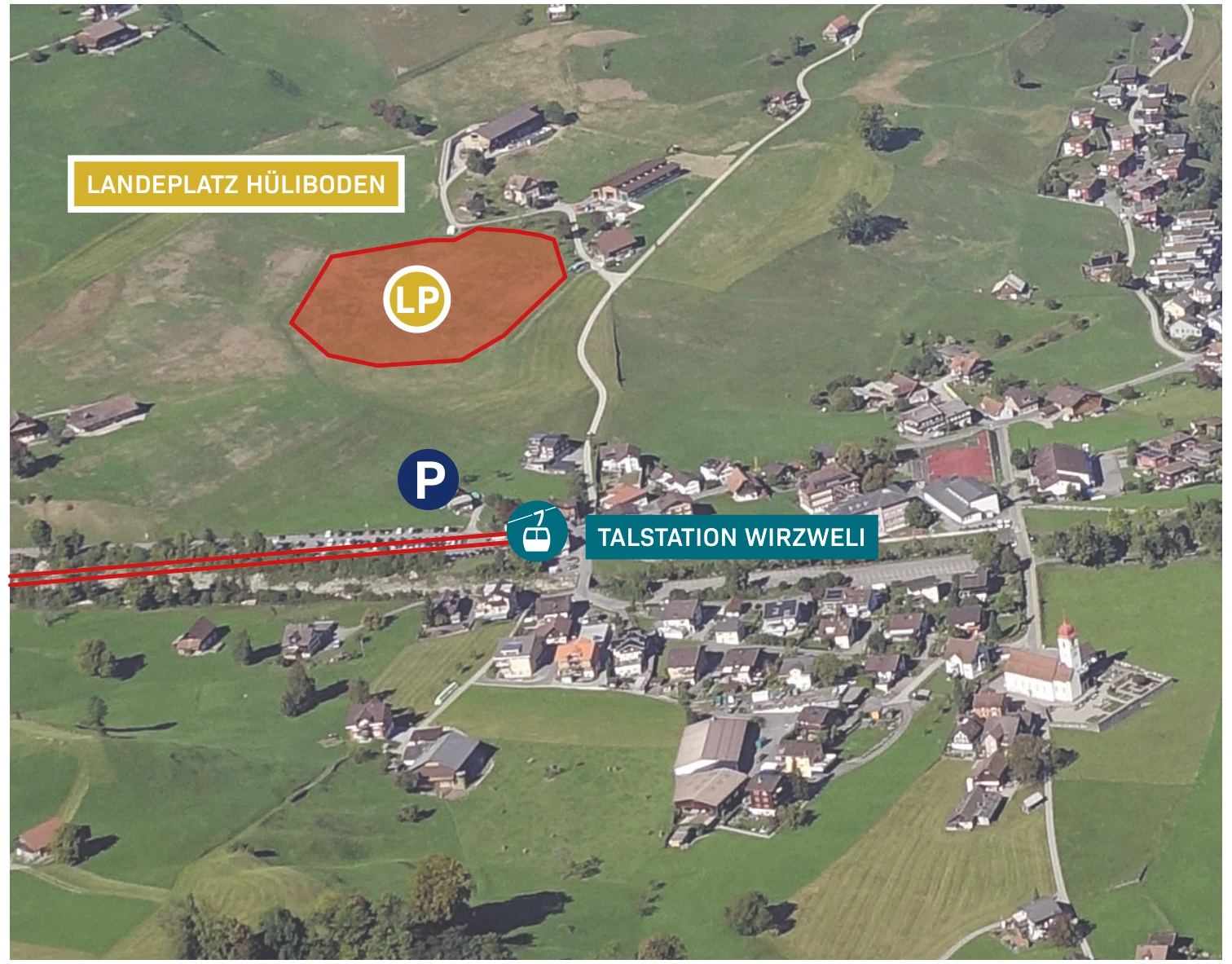
Hüliboden Dallenwil
Der Hanglandeplatz is located near the Wirzweli valley station. According to the guide, there is a windsock there; the cultivated areas are intended for landing.
View details ↗
Shooting Range Wolfenschiessen
The landing place is located on the main road at Schiessplatz between Dallenwil and Wolfenschiessen. It is listed in the guide as Wirzweli and Musenalp, among other places.
View details ↗Appreciate realistically
Requirements & Notes
- When flying towards Stanserhorn, please take into account the CTR Buochs.
- Choose the landing spot before takeoff; do not expect a guaranteed return to the Wirzwelibahn with a south-bound takeoff.
Further planning
Sources & current information
Basis: Flugguide Engelbergertal, Erich Lötscher & Dani Perret, 1st edition 2023, pages 20, 21, 22, 23, 24, 25, 26, 27. Text has been revised by the editorial team for this overview. Photos, maps and labeled topographic maps from the provided guide; source of maps according to the imprint: Federal Office for Land Surveying / © swisstopo. The image captions reflect the current status as of 2023.
← To the paragliding overview EngelbergertalAll paragliding contributions




