
Paragliding · Landing area · between Dallenwil and Wolfenschiessen
Paragliding landing area Shooting range Wolfenschiessen
The landing place is located on the main road at Schiessplatz between Dallenwil and Wolfenschiessen. It is listed in the guide as Wirzweli and Musenalp, among other places.
- Place
- between Dallenwil and Wolfenschiessen
- Type
- Landing place
- Height
- not clearly indicated separately in the PDF
- Data basis
- Guide 2023
Orientation
Landing area & approach
Before departure, check whether shooting operations are taking place. According to the guide, red cross markings on the ground and warning signs on the building mean that landing is not allowed there. The graphic shows the valley wind field, the ground handling area and a separate delta area.
From the flight guide
Map, Volten & Pictures
The graphic includes the original markings of the 2023 guide. Wind-dependent obstacles, obstacles, landing area, and usage rules before the flight on site are confirmed.

Clarify before landing
Important notes
- Blocked during shooting operation.
- The alternative designated in the historical topo for shooting operations is not an unverified general permit for landing; current local regulations confirm this.
After landing
Wrinkles & Return Journey
Use the designated routes and plan the return transport according to the departure track.
Suitable starting positions
Related flight areas

Wirzweli & Gummen
There are three different starting points near Dallenwil: at Wirzweli Station, at the Horn, and at Gummen. The guide describes the area for Soaring in the appropriate valley winds and for thermic flights from Gummen.
View details ↗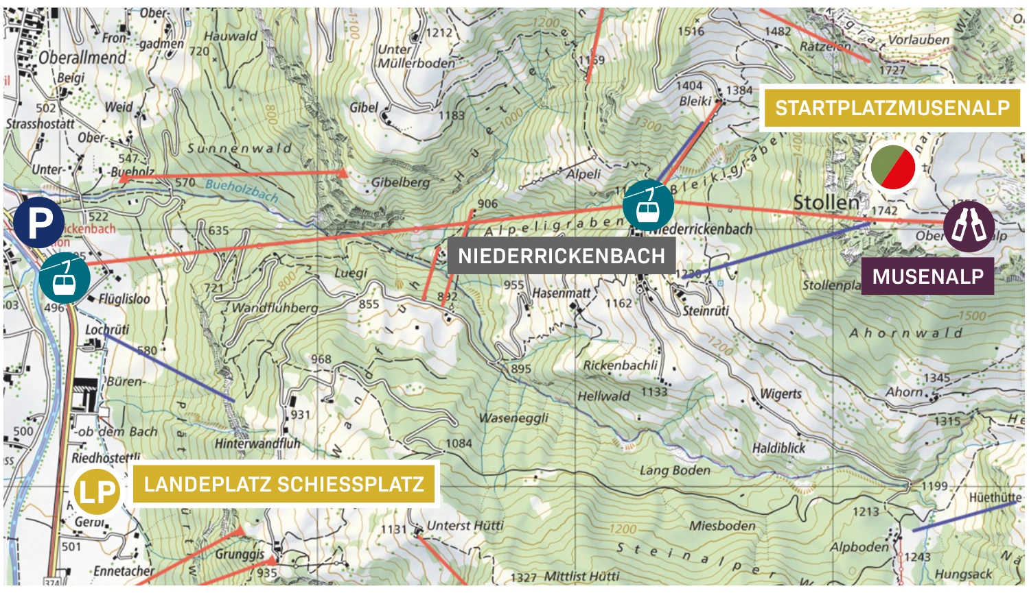
Musenalp
Above Niederrickenbach lies the Musenalp with its open meadows and small hills. The starting point is oriented west to northwest and is about ten minutes from the mountain station.
View details ↗Further planning
Sources & current information
Basis: Flugguide Engelbergertal, Erich Lötscher & Dani Perret, 1st edition 2023, pages 25. Text has been revised by the editorial team for this overview. Photos, maps and labeled topographic maps are from the guide provided; source of maps according to the imprint: Federal Office for State Topography / © swisstopo. The image captions reflect the current status as of 2023.




