Alpine hiking · Engelberg · South flank
Hahnen – over the southern flank to Engelberg’s mountain
The Hahnen stands directly above Engelberg. From the valley, its southern flank almost looks like a closed fortress. The route via Ober Zieblen finds its way through steep grassy slopes, rock steps and the exposed Hahnenband. Above, an impressive panoramic view of the village awaits. The ascent is an arduous alpine hike; the same steep passages must then be descended again.
- Summit
- 2606 m
- Difficulty
- T6− - demanding alpine hiking
- Time required from Engelberg
- Approximately 7–8 hours for ascent and descent
- Ascent from Engelberg
- Approximately 1600 m
- Alternative from Horbis
- Approximately 1480 m of ascent
- Descent
- Over the same southern flank
- Key points
- Hahnenband and summit ridge
- Conditions
- Dry and snow-free
The summit route begins above Ober Zieblen and is not a continuously marked mountain hiking trail. Plan the same level of attention and sufficient reserves for the descent.
Understand the line
Map and Topos
The overview map shows the two access routes from Engelberg and Horbis. The detailed map explains the upper part via the cable car and the summit ridge. The return route is described along the same southern route.
Interactive map of the area
Open the full-size map on swisstopo ↗
Save maps and topo maps offline before the tour. The drawings show the route; glacier status, snow conditions, closures, and safety equipment may change.
Open up the topo and maps


From the starting point to the summit
Route description
Engelberg or Horbis – Upper Zieblen
From Engelberg on the hiking trail via Berg and Unter Zieblen to Ober Zieblen. The start is slightly shorter in Horbis at «Ende der Welt»: via Zieblenzopf to the same alpine huts. From here onwards, the tour follows marked trails.
Ober Zieblen – Chli Hahnen
Leave the hiking trail at the huts and follow the trail to the ridge above the Alp. The trail leads to point 1909 and then to the right into the south flank of Chli Hahnen. Steep grassy passages require careful footing already here.
To the ribbon
The rock and scree steps described in the detailed plan lead to the band. Next come the exposed crossings at the base of the cliff faces. Loose stones and grass over hard ground deserve the same attention as the actual climbing points.
Through the summit ridge
Climb down the steep ravine below the divide between the front and main summit. Over the divide to the summit cross. The existing iron bars and securing points allow for rope securing; they do not form a continuously walkable fixed rope route.
Route, map and photos · Hahnen: Renovation and alpine character
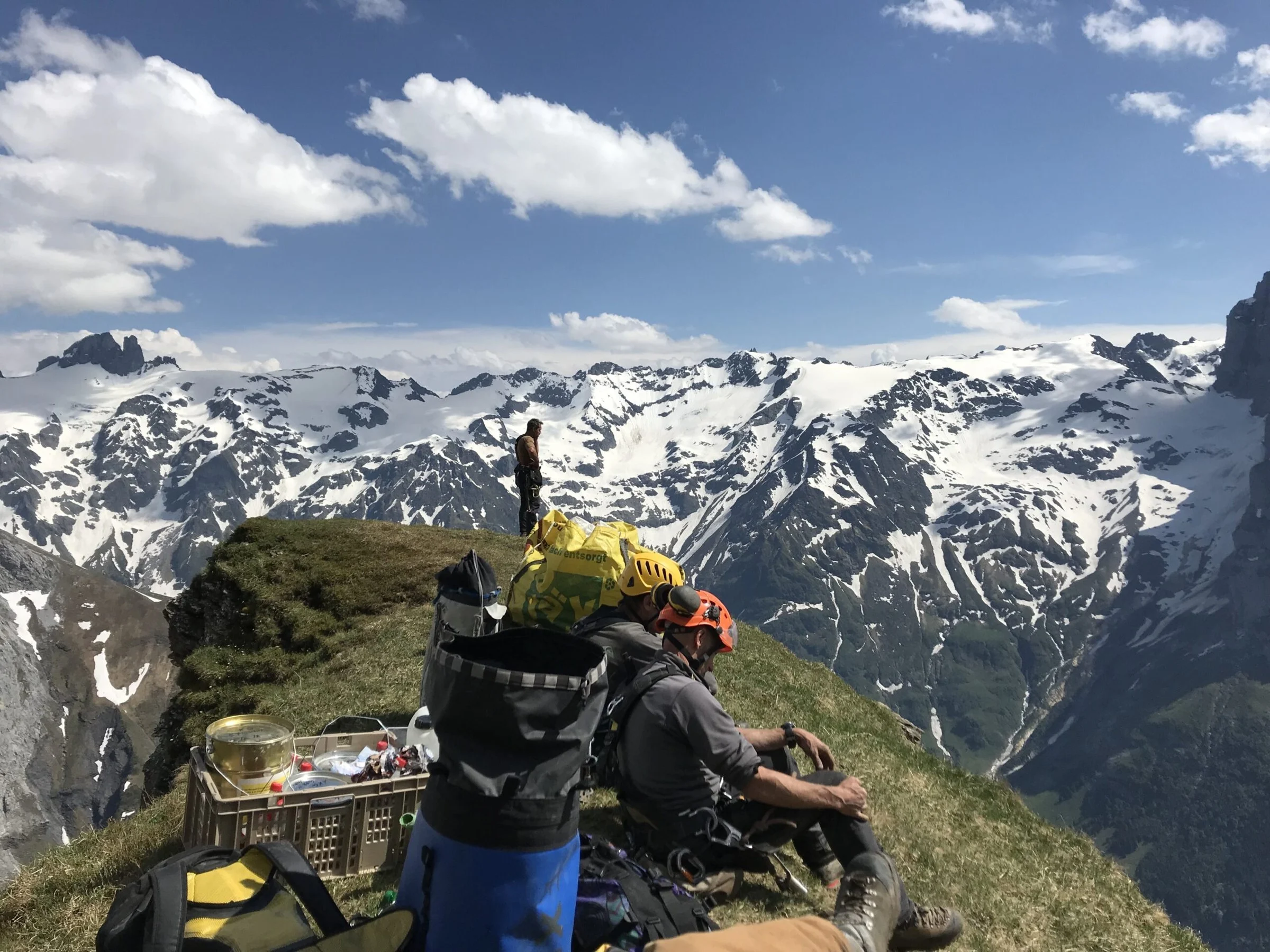
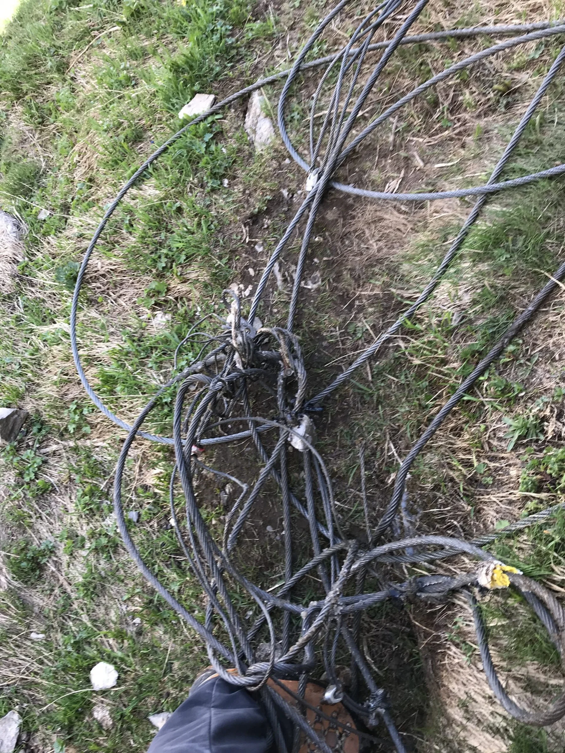
During the renovation in June 2019, damaged wire ropes, defective anchorages, and abandoned material depots were removed from the entire length of the cableway to the summit. Snow and natural events had partially torn down or destroyed old safety devices. New steel poles and intermediate safety devices were installed at the necessary locations; with a 40–50-meter-long climbing rope, it is possible to secure and rappel down from there.
It was deliberately not installed any fixed ropes. Permanently attached ropes take on large snow loads and cause winter damage; the then announcement therefore prohibits additional private fixed ropes. The Hahnen is not a climbing wall.
The tour requires experience in the T5–T6 range, footing, orientation in unmarked terrain, and safe handling of alpine equipment. Thistles, brittle rock, steep slopes, and exposed passages allow for no mistakes. The entire area is within the Swiss federal hunting reserve. The restoration notice was jointly published by the Unterwalden Mountain Guide Association, SAC Engelberg, and Engelberg-Titlis Tourism in June 2019.





The return is part of the tour
Descent and return journey
Back to Ober Zieblen via the summit ridge and the ropeway. The steep steps are often more difficult to climb down than to climb up. From the alpine huts on the hiking trail to Engelberg or via Zieblenzopf to Horbis back. There is no cable car to the Hahnen to shorten the distance.
What matters
Key points and conditions
Dry and snow-free conditions are crucial. Wet grass, frost or old snow can make the southern flank significantly more difficult. Fog makes it difficult to find your way between the rock ledges.
The previous fixings in the upper part have been removed. Iron bars and intermediate safety devices are used to secure the cable with a separate rope. Rockfall is a problem on the cables due to the fragile cable and the loose rocks.
The planners are assisted by Current situation around Engelberg. Re-check the weather, snow conditions and local advice before starting.
In keeping with the entire route
Equipment and requirements
- Sturdy mountain boots and helmet.
- Map and detailed plan offline; good orientation in rugged terrain.
- For the planned rope securing harness, 40-m-long rope, loops and appropriate securing or rappel equipment.
- Flashlight, weather protection, first aid, emergency equipment, food and plenty of water.
- Very good footing and no dizziness; experience with T5-/T6-terrain and long descents.
Dani Perret · IFMGA Mountain Guide
My tip
When ascending, evaluate every key point as a potential descent point as well. If a passage already proves difficult uphill, the return journey will be much more difficult without a suitable safety plan.
Insights into the terrain
Photos of the tour





Skyruns · Trailrunning · HELL
Hahnen as Skyrun
The Hahnen is a challenging destination for very experienced alpine runners. Up to Ober Zieblen, good mountain running elevation meters are the main focus. After that, a steep, partially exposed alpine terrain begins.
Running characteristics and classification
- Run the descent at a moderate pace or walk briskly and keep reserves for the summit build-up.
- After Ober Zieblen, the pace becomes more controlled with safe steps and navigation. The Hahnenband and summit ridge are approached with concentrated effort.
- Plan the entire descent in advance. There is no cable car at Hahnen that will get tired legs back up to speed.
Questions about the running variant
Does good mountain running fitness make it easier for the horses?
It helps with the approximately 1,600 meters of elevation gain. Regardless of this, the exposed and unsecured sections require the alpine skills described in the description.
Are the walking times also running times?
The time specifications in the tour description are not personal running times. In trail running, they depend especially on experience, running volume, conditions, and breaks. Technical difficulties remain unchanged.
Frequently asked questions
Is the hike to the Hahnen a normal mountain hike?
No. The south flank is rated T6−. Crossing over, extended grass crossings, and the summit ridge require a lot of alpine experience.
Do I need crampons?
The described summer tour is intended for dry, snow-free conditions. Snow and ice change the requirements; therefore, there is no general recommendation for winter or ice climbing.
Where is the best place to start?
Engelberg makes it possible to tour the area directly from the valley. Horbis shortens the ascent a little. Both routes meet at Ober Zieblen.
Local travel. Personally guided.
Roosters with mountain guide
Would you like to take this guided tour? We will discuss your experience, the appropriate date, and the current conditions. On the offer page, you will find the itinerary, the services, and the option to book or make an inquiry.