
Alpine North walls · Titlis · Engelberg Valley
Titlis Nordwand «Nord edge» in winter
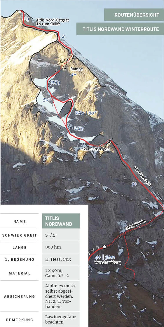
The Winter Line at the Titlis North slope uses snowfalls, ice fields, and snow or grass strips. Especially in the autumn when there is little snow, ice can form in the cracks. The route is indicated with S+ / 4+ and 900 meters of elevation gain and requires independent alpine safety equipment.
- Difficulty
- S+ / 4+
- Length
- 900 hm
- Total duration
- 6–7 hours
- Starting point
- Restaurant Wasserfall
- Altitude
- 1800–2700 m above sea level.
- Season
- November–December; possibly May
- Aspect
- N
- Character
- Alpine Winter Route
Starting point and access
boarding
From Restaurant Wasserfall to the north edge. The map shows the access route and the return route to the Stand station, with section times of 1 h 30 min and 1 h 45 min respectively. The entire tour takes 6–7 hours.

Route data and detailed maps
Route description
Compare difficulty, length and material. You can open the appropriate topo directly in the respective route box.
Titlis North Wall · Winter route
- Length
- 900 hm
- Rope
- 1 × 40 m
- Material
- Cams 0.2–2
- Hedging
- Alpine, self-locking; Normal hooks are partially present.
After a section marked with 4+ and 50 m on the topo, there are hiking trails, an ascending section with 3+ and a 20-m descent. Subsequently, ice fields lead up to WI3 and a ramp with 4+ into the upper wall area; the exit is at the northeast ridge.
First ascent: H. Hess, 1913.
Plan the return journey
Descent
The upper course reaches the north-east ridge. In the photo-topo, an hour to the ski lift is indicated from there. The area text lists the downhill section with the Titlis Express starting point for the return journey.
Ice formation and objective hazards
Safety and conditions
Avalanche danger is explicitly mentioned. The safety measures are taken in the alpine environment and must be largely self-made; normal climbing holds are sometimes available. The conditions from snowy autumn hikes should not be considered current conditions.
Check before the tour current conditions in Engelberg, that SLF avalanche bulletin and the weather development. The seasonal timeframes and walk-through photos do not replace an up-to-date assessment.
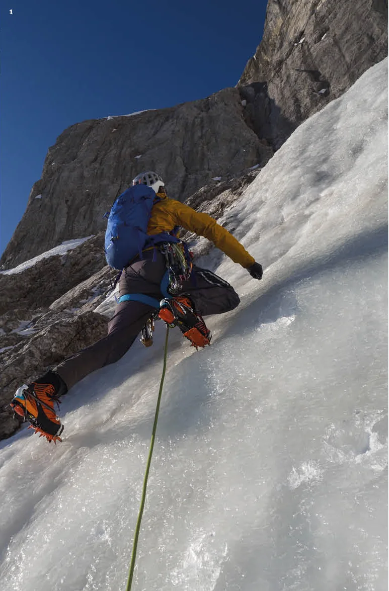
Ice and mixed in detail
Insights into the routes

Briefly answered
Questions about Titlis Nordwand «Nordkante» in winter
Is this the same side as the rock climbing routes on the Titlis Nordwand?
Here is a description of the alpine winter route on the northern edge. The separate multi-day routes on the Titlis Nordwand can be found in the MSL hiking data bank.
What time is the tour scheduled to start?
The entire tour takes 6–7 hours.
What difficulties does the winter route present?
S+ / 4+ at 900 m altitude. The topo also includes sections of ice up to WI3.
How do I get back to the valley?
The descent leads to the north-eastern ridge and on to the ski lift; the time for this is indicated in the topo as one hour. The text mentions the downhill section from the starting point using the Titlis Express.
Dani Perret · UIAGM/IFMGA mountain guide · Engelberg
Ice climbing tour with a mountain guide
Do you want to plan a line or work on your technique in the ice and mixed-surface area? Write to me about your experience and the goal you are interested in.
Further in the tour database





