
High tour · Stand · Titlis Glacier
Gross Titlis – from the base to the summit via the glacier
Above the operation of the cable cars lies the very summit of Titlis. The tour from the stand takes you over the summer trail to Rotegg, onto the Titlis glacier and finally to the West Ridge. From above you stand at 3238 meters, with a wide view over Engelberg and the surrounding Alps. The technical difficulties are manageable in good conditions. However, snow, ice and crevasses remain part of a high-altitude tour even in the middle of the ski area.
- Summit
- 3238 m
- Difficulty
- L · in good conditions
- Start
- Station Stand · 2428 m
- Ascent
- Approximately 810 m
- Return
- From the summit to Klein Titlis
- Descent
- Approximately 200–220 m to the mountain station
- Time required
- Approximately 4–5 hours for the described tour
- Short variant
- From Klein Titlis · approx. 200–220 m up and down
The base tour starts at Stand and ends at the Klein Titlis mountain station. The approximately 200 meters of descent do not count towards returning to Stand. Train times add to the time required.
Understand the line
Map and Topos
The map shows the ascent from the base and the return journey from the summit to Klein Titlis. Those who arrive at the top by train only plan the shorter ascent – based on their own assessment of snow, ice and the steep terrain.

Interactive map of the area
Open the full-size map on swisstopo ↗
Save maps and topo maps offline before the tour. The drawings show the route; glacier status, snow conditions, closures, and safety equipment may change.
From the starting point to the summit
Route description
Stand – Summer Route – Rotegg
From Stand towards Laubersgrat and via the summer path to Rotegg. The exact access depends on the facilities, local restrictions and the snow conditions. At the crossing to the glacier, you have to overcome rock steps or the existing facilities.
Over the Titlis glacier
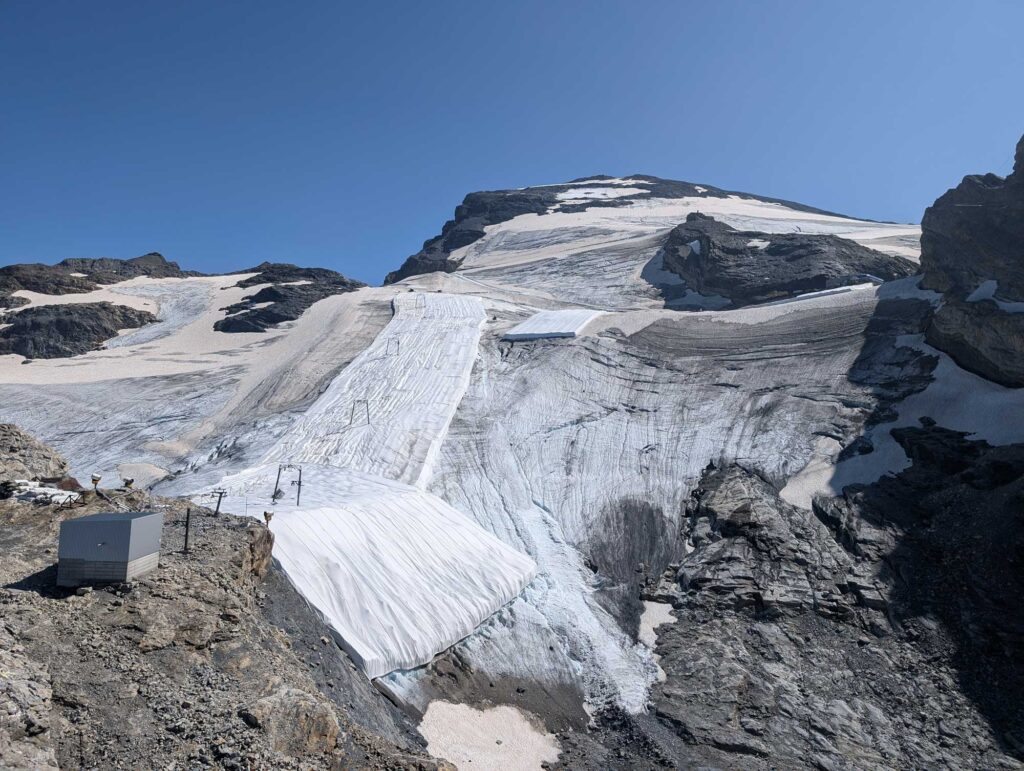
Climb the glacier towards the summit. Route selection, belaying, and equipment are adapted to the crevasses, snow bridges, and ice. A slope or protective fleece is not a general guarantee that the terrain beyond is safe to walk on.
On the Gross Titlis
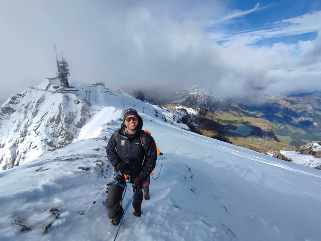
In the upper area towards the west ridge and over snow, firn or open rock and rubble areas to the summit. Especially on the south side, keep a distance from possible obstacles. In case of freezing, the comparatively easy final ascent becomes challenging as well.
The return is part of the tour
Descent and return journey
Back via the West Ridge to Klein Titlis and the open mountain station. This return route includes approximately 200–220 meters of descent. A return by foot is another, longer route that requires further assessment of the glacier. The train option is only operable during actual operation.
What matters
Key points and conditions
The route through the Titlis Glacier and a descent through the Steinberg or Galtiberg area are different adventures. The basic tour described here leads from the summit to Klein Titlis back down.
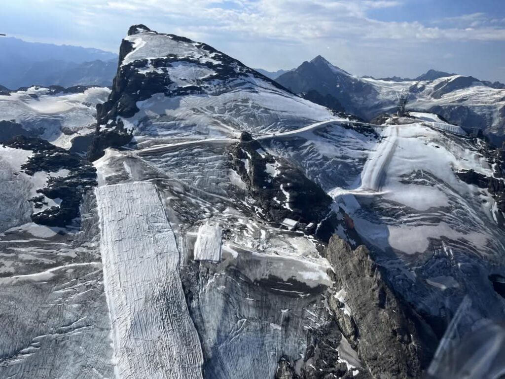
Protective mats change the appearance of the ice. They do not replace ice climbing techniques or glacier assessment. Please be aware of construction sites, barriers and altered access points at the mountain stations on site.
Plan in time for anchoring, the summit section and the return. Do not rely on an apparently always-present trail in fog, new snow or hard ice.
The planners are assisted by Current situation around Engelberg. Re-check the weather, snow conditions and local advice before starting.
In keeping with the entire route
Equipment and requirements
- Hiking boots, suitable crampons and picks for snow and ice passages.
- Belay rope, glacier rope and equipment, as well as skills for vertical rescue.
- Map offline, sun protection, warm clothing, weather protection and emergency equipment.
- Stability on foot, safe ice climbing techniques and fitness for around 800 meters of elevation gain from a standing position.
Dani Perret · IFMGA Mountain Guide
My tip
First decide which summit tour you want to do: the full ascent from Stand or the short summit section from Klein Titlis. Only then do altitude meters, schedule, and the train ticket fit together.
Insights into the terrain
Photos of the tour
Skyruns · Trailrunning · HELL
Gross Titlis Normal Route as Skyrun
From the village to the Gross Titlis, there are over 2,200 meters of elevation gain. The lower part can be done as a mountain run. At least at the glacier, it becomes a high-altitude tour with all the requirements for equipment and a rope team.
Running characteristics and classification
- Plan the ascent of the valley via Gerschnialp and Trübsee as a separate section. The hiking data for the normal route above begin only at that point.
- Before the glacier, perform a conscious check of equipment and conditions. Running fitness does not replace ice climbing techniques or pillar rescue.
- Plan for summits and a return to the open mountain station with sufficient time reserve.
Questions about the running variant
Are running shoes suitable for the Gross Titlis?
A blanket approval would be wrong. Snow, ice, crevasses and the planned securing determine the equipment. The high-altitude tour is planned with suitable footwear, glacier equipment and the necessary experience.
Are the walking times also running times?
The time specifications in the tour description are not personal running times. In trail running, they depend especially on experience, running volume, conditions, and breaks. Technical difficulties remain unchanged.
Frequently asked questions
Does the train run on the Gross Titlis?
The cable car reaches the area of Klein Titlis. The Groß Titlis is a separate, higher peak that can be reached on foot.
Is the Gross Titlis a hiking mountain?
Under favorable conditions, the final ascent is technically relatively easy. However, the route described from the trailhead leads over a glacier and requires appropriate equipment and experience.
Are the protective mats a safe way to climb?
No. The course, conditions, and surroundings change. Observe the barriers and assess the actual ice and crevasses conditions.
Local travel. Personally guided.
Gross Titlis with mountain guide
Would you like to take this guided tour? We will discuss your experience, the appropriate date, and the current conditions. On the offer page, you will find the itinerary, the services, and the option to book or make an inquiry.




