
Paragliding · Beckenried
Paragliding Klewenalp – Launch sites & flight area
From Klewenalp, the view opens up over Lake Vierwaldstättersee. The Nordstartwiese is located east of the mountain station; the landing area is in Beckenried near the Oberen Allmend.
- Region
- Beckenried
- Starting places
- 1
- Takeoff altitudes
- 1593 m according to the guide
- Exploration
- Cableway and footpath
- Ground base
- Flight Guide 2023
- Airspace
- Check current conditions before every flight
From the flight guide
The flight area
From Klewenalp, the view opens up over Lake Vierwaldstättersee. The Nordstartwiese is located east of the mountain station; the landing area is in Beckenried near the Oberen Allmend.
In addition to the abseiling route to Beckenried, the guide Soaring mentions Nordwind and thermal connection options towards Niederbauen. Leave the maneuver box above the lake for acro training free.
To the starting point
Arrival & Check-in
Take the cable car from Beckenried to Klewenalp. According to the guide, the starting point is about 300 meters east of the mountain station. Check the current train schedule and local information.
Space for space
The starting positions
Klewenalp Mountain Station
North-facing meadow with a view of the lake. The guide describes the start when the wind is suitable for north-facing slopes.
- Height
- 1593 m (Guide 2023)
- Orientation
- North
- Coordinates
- 678’961 / 199’331 (LV03, book entry)
- boarding
- about 300 meters east of the mountain station
- underground
- Grass
CTR Buochs and local special regulations are essential for flight planning.
Orientation
Maps, Topos & Images
All associated graphics from the flight guide are fully reproduced here with their labeled instructions. Maps and topographic maps are displayed in their original aspect ratio. Labels, cable instructions, and markings: as of 2023.


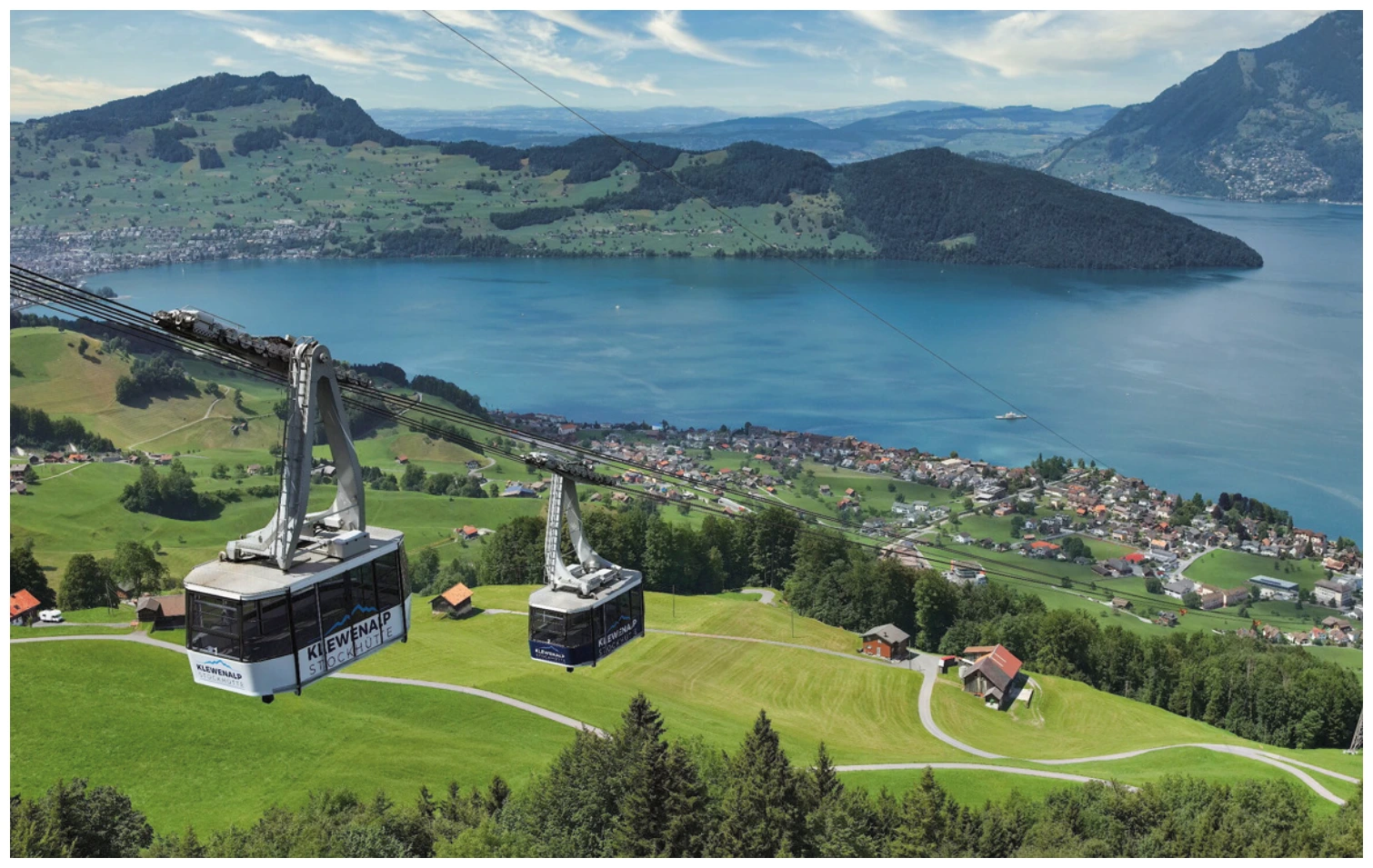
Set goals before starting
Landing places
Choose a suitable and permissible landing before takeoff. The places linked here are area options and do not guarantee the availability of any landing spot.
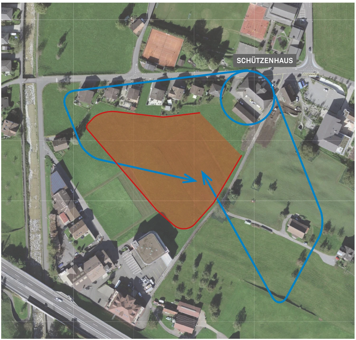
Beckenried / Upper Allmend
The landing area is located above the shooting range at the Oberen Allmend. Landings are permitted on the designated meadow with a windsock.
View details ↗Appreciate realistically
Requirements & Notes
- The tower times mentioned in the 2023 guide are not an actual flight clearance. SHV special regulations and notices apply.
- Do not include the descent in the acro maneuvers box.
- Only use the designated meadow with the windsock above the shooting range.
Further planning
Sources & current information
Basis: Flugguide Engelbergertal, Erich Lötscher & Dani Perret, 1st edition 2023, pages 64, 65, 66, 67. Text has been revised for this overview. Photos, maps and labeled topographic maps from the provided guide; source of maps according to the imprint: Federal Office for State Topography / © swisstopo. The image captions reflect the current status as of 2023.
← To the paragliding overview EngelbergertalAll paragliding contributions




